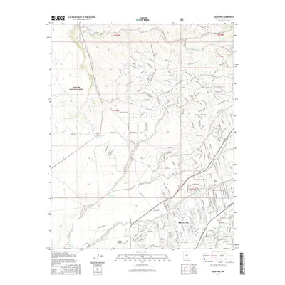
2017 Map of Agua Fria
USGS Topo · Published 2017About this map
Santa Fe and the village of Agua Fria anchor this 2017 study of the high desert terrain where urban expansion meets the Santa Fe National Forest. The landscape is defined by the sharp transition from the residential street grids and the Santa Fe Municipal Airport to the open expanses of the Caja del Rio Plateau. A complex network of drainage features like Arroyo Calabasas and Cañada Ancha illustrates the natural hydrology of the area, while historical markers such as San Isidro Cem provide touchpoints for local genealogy. The presence of Southwestern Coll and various ranch-related features like Headquarters Well shows the mix of institutional development and traditional land use. To the south and west, the Santa Fe River and Arroyo de los Chamisos cut through the volcanic tablelands, marking the geographic boundaries of the growing city.
Find a feature on this map
218 named features on this map. Tap any name to fly to it.
Don’t see what you’re looking for? This feature index may not catch every label — zoom into the map to look around manually.
Map Details
Editions of this 2017 Agua Fria Map
This is the sole edition of this map. No revisions or reprints were ever made.
Other maps of this area

1889 · Santa Fe
USGS Topo · 1:125,000

1892 · Santa Clara
USGS Topo · 1:125,000

1894 · Santa Fe
USGS Topo · 1:125,000

1951 · Agua Fria
USGS Topo · 1:24,000

1951 · Turquoise Hill
USGS Topo · 1:24,000

1952 · Santa Fe
USGS Topo · 1:24,000

1952 · Turquoise Hill
USGS Topo · 1:24,000

1952 · Seton Village
USGS Topo · 1:24,000

1952 · White Rock
USGS Topo · 1:24,000

1952 · Montoso Peak
USGS Topo · 1:24,000