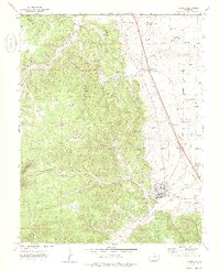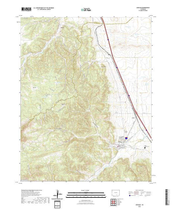
2022 Map of Aguilar
USGS Topo · Published 2022About this map
Aguilar sits as a primary settlement in this northern Las Animas County landscape, situated where the high plains meet the intricate canyon systems of the Sangre de Cristo foothills. The map reveals a complex network of geological and industrial markers, including the Kirkland Pit and remnants of mining-related infrastructure near Rouse and Rugby. The terrain is defined by dramatic erosion features like Brodhead Canyon and Black Hawk Canyon, which give way to high flats such as Goat Ranch Flat. Water management is central to the area's development, evidenced by the Apishapa River and the Borrego Ditch irrigation system. Local history is anchored by Saint Anthony Cem and the small siding at Lynn, reflecting a pattern of settlement tied to early 20th-century coal mining and the transit corridor that continues to shape the region.
Find a feature on this map
75 named features on this map. Tap any name to fly to it.
Don’t see what you’re looking for? This feature index may not catch every label — zoom into the map to look around manually.
Map Details
Editions of this 2022 Aguilar Map
This is the sole edition of this map. No revisions or reprints were ever made.