1971 Map of Aguilar
USGS Topo · Published 1974About this map
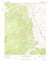
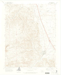
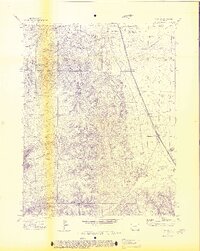
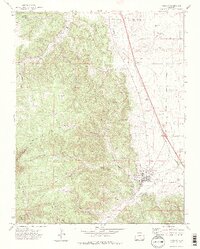
Aguilar sits at the base of the foothills where the Apishapa River flows eastward, serving as a hub for the surrounding mining and ranching district. The industrial character of the early 1970s is evident in the dense concentration of coal workings, including the Black Hawk Mine, Rapson Mine, and the Southwestern Mine. While some locations like Rouse are marked as former settlements, others such as Brodhead and Gonzales remain part of a landscape defined by deep canyons and flat-topped mesas like Big Flat. Transport and commerce follow the corridor of the Colorado and Southern railroad and the Borrego Ditch, which parallel the mountain front. This topography, ranging from the heights of Bunker Hill down to the Salado Creek drainage, illustrates the historical reliance on both mineral extraction and water management in this part of Southern Colorado.
Find a feature on this map
44 named features on this map. Tap any name to fly to it.
Don’t see what you’re looking for? This feature index may not catch every label — zoom into the map to look around manually.
Map Details
Editions of this 1971 Aguilar Map
4 editions found
Other maps of this area

1891 · Walsenburg
USGS Topo · 1:125,000

1891 · Spanish Peaks
USGS Topo · 1:125,000

1893 · Spanish Peaks
USGS Topo · 1:125,000

1894 · Walsenburg
USGS Topo · 1:125,000

1895 · Spanish Peaks
USGS Topo · 1:125,000

1897 · Walsenburg
USGS Topo · 1:125,000

1897 · Spanish Peaks
USGS Topo · 1:125,000

1900 · Spanish Peaks
USGS Topo · 1:125,000

1900 · Walsenburg
USGS Topo · 1:125,000

1954 · Trinidad
USGS Topo · 1:250,000