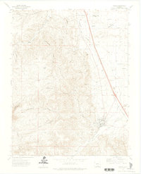
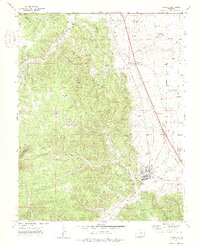
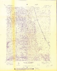
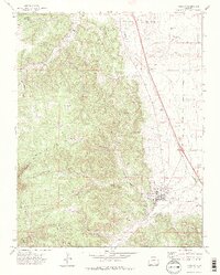
1971 Map of Aguilar
USGS Topo · Published 1974About this map
The Apishapa River cuts through the canyonlands of southern Colorado, providing the vital water source for the town of Aguilar. In the early 1970s, this landscape reflected a long history of resource extraction, with the Colorado and Southern railroad connecting coal camps and industrial sites. While the town of Aguilar remains the primary hub, the map documents the locations of several smaller settlements and operations like Brodhead, Rugby, and the Rouse (Site).
Find a feature on this map
43 named features on this map. Tap any name to fly to it.
Don’t see what you’re looking for? This feature index may not catch every label — zoom into the map to look around manually.
Map Details
Editions of this 1971 Aguilar Map
4 editions found
Other maps of this area

1891 · Walsenburg
USGS Topo · 1:125,000

1891 · Spanish Peaks
USGS Topo · 1:125,000

1893 · Spanish Peaks
USGS Topo · 1:125,000

1894 · Walsenburg
USGS Topo · 1:125,000

1895 · Spanish Peaks
USGS Topo · 1:125,000

1897 · Walsenburg
USGS Topo · 1:125,000

1897 · Spanish Peaks
USGS Topo · 1:125,000

1900 · Spanish Peaks
USGS Topo · 1:125,000

1900 · Walsenburg
USGS Topo · 1:125,000

1954 · Trinidad
USGS Topo · 1:250,000