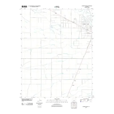
2010 Map of Alamosa West
USGS Topo · Published 2010About this map
Agricultural irrigation networks dominate the San Luis Valley landscape west of Alamosa in this 2010 study. A sophisticated web of man-made waterways, including the Denver Colony Lateral, Alamosa Farm Lateral, and Empire Lateral, crisscrosses the high desert floor to support local farming operations. These engineered channels run parallel to natural drainage systems like Rock Creek and Cat Creek, illustrating the extensive water management required to sustain the region's economy. Small rural hubs such as Henry, Hartner, and La Fruto are situated along the transit corridors south of the city, while the Rio Grande and Alamosa River anchor the northern and southern reaches of the map respectively. The presence of the Harmony Pit near the city center indicates local industrial activity amid the surrounding grid of county roads and expansive fields.
Find a feature on this map
53 named features on this map. Tap any name to fly to it.
Don’t see what you’re looking for? This feature index may not catch every label — zoom into the map to look around manually.
Map Details
Editions of this 2010 Alamosa West Map
This is the sole edition of this map. No revisions or reprints were ever made.
Other maps of this area

1915 · Del Norte
USGS Topo · 1:125,000

1917 · Del Norte
USGS Topo · 1:125,000

1922 · Conejos
USGS Topo · 1:125,000

1945 · Durango
USGS Topo · 1:250,000

1953 · Durango
USGS Topo · 1:250,000

1954 · Durango
USGS Topo · 1:250,000

1954 · Trinidad
USGS Topo · 1:250,000

1955 · Trinidad
USGS Topo · 1:250,000

1958 · Trinidad
USGS Topo · 1:250,000

1959 · Trinidad
USGS Topo · 1:250,000