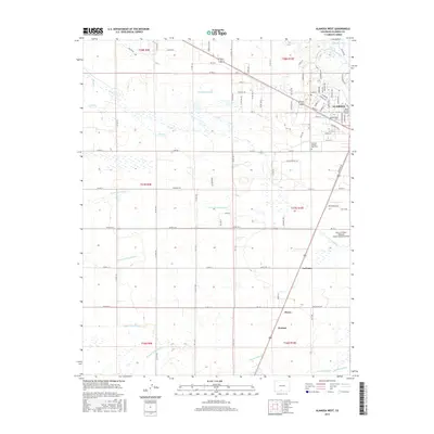
2016 Map of Alamosa West
USGS Topo · Published 2016About this map
The city of Alamosa serves as the focal point for this 2016 survey, anchored by the campus of Adams State Univ and the Alamosa Spanish Cem 1913. The landscape reveals a complex network of water management essential to the region's agricultural history, featuring an intricate system of canals and ditches such as the Loveland Lateral, Denver Colony Lateral, and Waverly Drain Ditch. These man-made channels crisscross the terrain between the Rio Grande to the northeast and the Alamosa River to the south.
Find a feature on this map
105 named features on this map. Tap any name to fly to it.
Don’t see what you’re looking for? This feature index may not catch every label — zoom into the map to look around manually.
Map Details
Editions of this 2016 Alamosa West Map
This is the sole edition of this map. No revisions or reprints were ever made.
Other maps of this area

1915 · Del Norte
USGS Topo · 1:125,000

1917 · Del Norte
USGS Topo · 1:125,000

1922 · Conejos
USGS Topo · 1:125,000

1945 · Durango
USGS Topo · 1:250,000

1953 · Durango
USGS Topo · 1:250,000

1954 · Durango
USGS Topo · 1:250,000

1954 · Trinidad
USGS Topo · 1:250,000

1955 · Trinidad
USGS Topo · 1:250,000

1958 · Trinidad
USGS Topo · 1:250,000

1959 · Trinidad
USGS Topo · 1:250,000