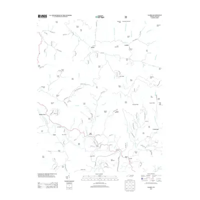
2013 Map of Alarka
USGS Topo · Published 2013About this map
The Little Tennessee River winds through the southwestern portion of this landscape, acting as a focal point for settlements like Stiles and Shallow Ford. The terrain is characterized by a dense network of ridges and coves, including Bryson Cove and Wests Cove, which have historically dictated the placement of mountain communities. Many local roads, such as Cowee School Rd and Alarka Rd, follow the natural contours of the valley floors, connecting small hubs like Cowee and Oak Grove.
Find a feature on this map
161 named features on this map. Tap any name to fly to it.
Don’t see what you’re looking for? This feature index may not catch every label — zoom into the map to look around manually.
Map Details
Editions of this 2013 Alarka Map
This is the sole edition of this map. No revisions or reprints were ever made.
Other maps of this area

1891 · Cowee
USGS Topo · 1:125,000

1897 · Cowee
USGS Topo · 1:125,000

1907 · Cowee
USGS Topo · 1:125,000

1933 · Bryson
USGS Topo · 1:62,500

1933 · Bushnell
USGS Topo · 1:62,500

1935 · Franklin
USGS Topo · 1:24,000

1935 · Burningtown Bald
USGS Topo · 1:24,000

1935 · Wayah Bald
USGS Topo · 1:48,000

1935 · Corbin Knob
USGS Topo · 1:24,000
1936 · Greens Creek
USGS Topo · 1:24,000