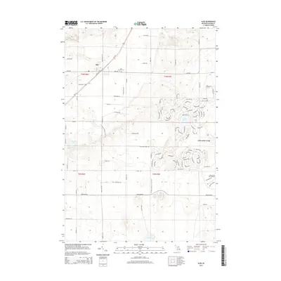
2014 Map of Alba
USGS Topo · Published 2014About this map
Alba serves as the primary hub in this portion of Antrim County, situated at the junction of S Us-131 and the Alba Hwy. The landscape is a mix of traditional rural infrastructure, such as the Star Township Cem, and modern recreational developments. The eastern portion of the map is dominated by the sprawling residential and resort community known as Lakes of the North, complete with its own Lakes of the North Airport. This development represents a significant transition from the surrounding agricultural and wooded sections. Terrain and outdoor recreation are highlighted by the N Country National Scenic Trail winding through the central corridor, passing near numerous small water bodies including Lake Harold and Wetzel Lake. The road network, including family-named routes like Kregulka Rd and Tucker Rd, suggests a long-standing pattern of rural land division and settlement.
Find a feature on this map
95 named features on this map. Tap any name to fly to it.
Don’t see what you’re looking for? This feature index may not catch every label — zoom into the map to look around manually.
Map Details
Editions of this 2014 Alba Map
This is the sole edition of this map. No revisions or reprints were ever made.
Other maps of this area

1954 · Traverse City
USGS Topo · 1:250,000

1955 · Cheboygan
USGS Topo · 1:250,000

1956 · Alba
USGS Topo · 1:62,500

1956 · Mancelona
USGS Topo · 1:62,500

1958 · Cheboygan
USGS Topo · 1:250,000

1958 · Traverse City
USGS Topo · 1:250,000

1961 · Boyne Falls
USGS Topo · 1:62,500

1961 · Boyne City
USGS Topo · 1:62,500

1975 · Mancelona NE
USGS Topo · 1:24,000

1982 · Petoskey
USGS Topo · 1:100,000