
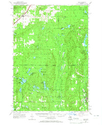
1956 Map of Alba
USGS Topo · Published 1956About this map
The Pennsylvania RR railroad corridor defines the northwestern corner of this landscape, passing through the settlement of Alba where a local Cem and the surrounding townships of Chestonia and Star meet. This mid-century survey captures a region dominated by conservation and recreation, split between the Pigeon River State Forest and the Au Sable State Forest. The interior is dotted with dozens of glacial lakes, from the large Starvation Lake and Blue Lake to smaller, family-named features like MacNeil Pond and Waddell Pond. Educational and community outposts like Barnhart Sch and Blue Lake Sch appear alongside scout camps like Camp Flying Eagle, while fire protection is evidenced by the Hayes Lookout Tower and Deward Lookout Tower. The drainage patterns of the Manistee River and the Pigeon River flow through these protected woodlands, connecting remote hamlets like Deward and Frederic.
Find a feature on this map
75 named features on this map. Tap any name to fly to it.
Don’t see what you’re looking for? This feature index may not catch every label — zoom into the map to look around manually.
Map Details
Editions of this 1956 Alba Map
3 editions found
Other maps of this area

1949 · Black Creek
USGS Topo · 1:24,000

1949 · Otsego Lake
USGS Topo · 1:62,500

1949 · Fletcher
USGS Topo · 1:62,500

1949 · Grayling
USGS Topo · 1:62,500

1950 · Lake Margrethe
USGS Topo · 1:24,000

1950 · Grayling
USGS Topo · 1:24,000

1951 · Big Bradford Lake
USGS Topo · 1:24,000

1951 · Grayling
USGS Topo · 1:24,000

1951 · Otsego Lake
USGS Topo · 1:24,000

1954 · Gaylord
USGS Topo · 1:62,500