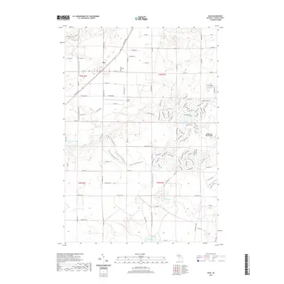
2019 Map of Alba
USGS Topo · Published 2019About this map
Alba serves as the central hub of this northern Michigan landscape, situated at the junction of the Mackinaw Trl and Alba Hwy. The area is characterized by a mix of established community markers and modern residential developments, with the Star Township Cem providing a historical anchor for local genealogy. To the east, the sprawling complex of Lakes of the North and Air Park North illustrates the transition of the region into a destination for recreation and aviation. The terrain is marked by numerous kettle lakes including Lake Harold, Wetzel Lake, and Five Lake, which dictate the winding paths of roads like Shadyshore Pkwy. Outdoor recreation is further evidenced by the long-distance N Country Trail/Iron Belle Trail, which traverses the township from north to south, passing through the undulating glacial topography.
Find a feature on this map
110 named features on this map. Tap any name to fly to it.
Don’t see what you’re looking for? This feature index may not catch every label — zoom into the map to look around manually.
Map Details
Editions of this 2019 Alba Map
This is the sole edition of this map. No revisions or reprints were ever made.
Other maps of this area

1954 · Traverse City
USGS Topo · 1:250,000

1955 · Cheboygan
USGS Topo · 1:250,000

1956 · Alba
USGS Topo · 1:62,500

1956 · Mancelona
USGS Topo · 1:62,500

1958 · Cheboygan
USGS Topo · 1:250,000

1958 · Traverse City
USGS Topo · 1:250,000

1961 · Boyne Falls
USGS Topo · 1:62,500

1961 · Boyne City
USGS Topo · 1:62,500

1975 · Mancelona NE
USGS Topo · 1:24,000

1982 · Petoskey
USGS Topo · 1:100,000