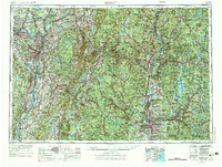
1956 Map of Albany
USGS Topo · Published 1976About this map
The Hudson River and Connecticut River valleys anchor this mid-1970s overview of the Northeast, illustrating a region defined by its industrial hubs and protected highlands. Major population centers like Albany, Troy, and Springfield appear at their height of mid-century development, connected by the burgeoning paths of the New York State Thruway and the Massachusetts Turnpike. The landscape is dominated by the Green Mountains and Berkshire Hills, where extensive state forests like Savoy Mountain State Forest and October Mountain State Forest frame the terrain.
Find a feature on this map
216 named features on this map. Tap any name to fly to it.
Don’t see what you’re looking for? This feature index may not catch every label — zoom into the map to look around manually.
Map Details
Editions of this 1956 Albany Map
2 editions found

Other maps of this area

1885 · Northampton
USGS Topo · 1:62,500

1885 · Sheffield
USGS Topo · 1:62,500

1885 · Worcester
USGS Topo · 1:62,500

1886 · Greylock
USGS Topo · 1:62,500

1886 · Springfield
USGS Topo · 1:62,500

1886 · Hawley
USGS Topo · 1:62,500

1886 · Chesterfield
USGS Topo · 1:62,500

1886 · Worcester
USGS Topo · 1:62,500

1886 · Northampton
USGS Topo · 1:62,500

1886 · Becket
USGS Topo · 1:62,500