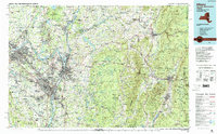
1989 Map of Albany
USGS Topo · Published 1989About this map
The Hudson River and Mohawk River confluence serves as the industrial and political anchor for this region, where the urban centers of Albany, Troy, and Schenectady meet. By the late 1980s, the landscape shows a mature network of transportation, with the Conrail and Delaware and Hudson Railway lines running alongside major modern thoroughfares like Interstate 87. The state’s political seat is centered at the New York State Capitol, while the long history of regional defense is preserved at the Watervliet Arsenal.
Find a feature on this map
423 named features on this map. Tap any name to fly to it.
Don’t see what you’re looking for? This feature index may not catch every label — zoom into the map to look around manually.
Map Details
Editions of this 1989 Albany Map
2 editions found
Other maps of this area

1886 · Greylock
USGS Topo · 1:62,500

1886 · Hawley
USGS Topo · 1:62,500

1886 · Chesterfield
USGS Topo · 1:62,500

1886 · Becket
USGS Topo · 1:62,500

1888 · Becket
USGS Topo · 1:62,500

1888 · Berlin
USGS Topo · 1:62,500

1888 · Chesterfield
USGS Topo · 1:62,500

1888 · Pittsfield
USGS Topo · 1:62,500

1889 · Wilmington
USGS Topo · 1:62,500

1890 · Hawley
USGS Topo · 1:62,500