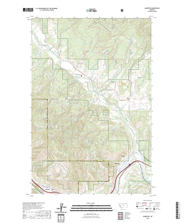
2024 Map of Alberton
USGS Topo · Published 2024About this map
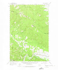
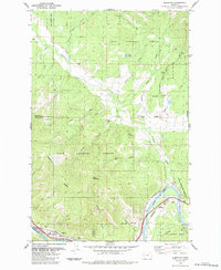
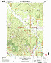
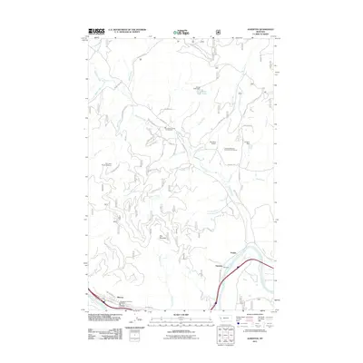
The Clark Fork river and the BNSF Railway corridor define the southern edge of this western Montana landscape, where the town of Alberton serves as a gateway to the steep mountain drainages of the Lolo National Forest. The map documents a rugged interior shaped by the Ninemile Creek watershed, which carves through the terrain between the Ninemile Divide and Ellis Mtn. Smaller settlements like Ninemile and Soudan are situated near the river valley, while the uplands are crisscrossed by forest service roads and recreational paths such as the Grand Menard Envir Discovery Trl. North of the Nine Mile Airport, the Kreis Pond area features an intricate network of color-coded loop trails, reflecting the contemporary multi-use management of these public lands. This 2024 data reveals the intersection of historic rail infrastructure with modern conservation and recreation networks.
Find a feature on this map
72 named features on this map. Tap any name to fly to it.
Don’t see what you’re looking for? This feature index may not catch every label — zoom into the map to look around manually.
Map Details
Editions of this 2024 Alberton Map
This is the sole edition of this map. No revisions or reprints were ever made.
Historical Maps of Alberton Through Time
8 maps found