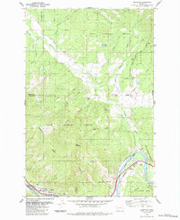
1984 Map of Alberton
USGS Topo · Published 1984About this map
The town of Alberton serves as the focal point for this 1984 survey, situated along the southern edge of the Lolo National Forest where the Clark Fork river cuts through the valley. This landscape is defined by the sharp transition from the river bottom to the high elevations of the Ninemile Divide and Ellis Mountain. The map illustrates a heavy reliance on the river and rail corridors, with the Burlington Northern line and an Old Railroad Grade tracing the winding path of the water.
Find a feature on this map
38 named features on this map. Tap any name to fly to it.
Don’t see what you’re looking for? This feature index may not catch every label — zoom into the map to look around manually.
Map Details
Editions of this 1984 Alberton Map
This is the sole edition of this map. No revisions or reprints were ever made.
Other maps of this area

1911 · Lolo
USGS Topo · 1:250,000

1912 · Missoula
USGS Topo · 1:125,000

1913 · Lolo
USGS Topo · 1:250,000

1956 · Wallace
USGS Topo · 1:250,000

1956 · Hamilton
USGS Topo · 1:250,000

1959 · Hamilton
USGS Topo · 1:250,000

1959 · Tarkio
USGS Topo · 1:62,500

1959 · Alberton
USGS Topo · 1:62,500

1960 · Wallace
USGS Topo · 1:250,000

1960 · Hamilton
USGS Topo · 1:250,000