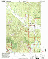
1999 Map of Alberton
USGS Topo · Published 2003About this map
Alberton sits along the southern bend of the Clark Fork river, serving as a gateway to the dense forest lands of the Lolo National Forest. This late-twentieth-century revision highlights the intersection of valley settlement and federal land management, centered on the Ninemile Remount Depot Ninemile Ranger Sta and the nearby CCC Campsite. The landscape is dominated by significant elevation changes, from the riverbanks up to the Ninemile Divide and peaks such as Ellis Mountain and Petty Mountain. Drainage networks like Ninemile Creek, Butler Creek, and Stony Creek carve through the terrain, while the presence of a Landing Strip and Discovery Trail indicates a mix of administrative, transport, and recreational use of the backcountry during this era.
Find a feature on this map
33 named features on this map. Tap any name to fly to it.
Don’t see what you’re looking for? This feature index may not catch every label — zoom into the map to look around manually.
Map Details
Editions of this 1999 Alberton Map
This is the sole edition of this map. No revisions or reprints were ever made.
Other maps of this area

1911 · Lolo
USGS Topo · 1:250,000

1912 · Missoula
USGS Topo · 1:125,000

1913 · Lolo
USGS Topo · 1:250,000

1956 · Wallace
USGS Topo · 1:250,000

1956 · Hamilton
USGS Topo · 1:250,000

1959 · Hamilton
USGS Topo · 1:250,000

1959 · Tarkio
USGS Topo · 1:62,500

1959 · Alberton
USGS Topo · 1:62,500

1960 · Wallace
USGS Topo · 1:250,000

1960 · Hamilton
USGS Topo · 1:250,000