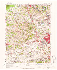
1957 Map of Alburtis
USGS Topo · Published 1966About this map
Muhlenberg College and Cedar Crest College anchor the eastern edge of this mid-century landscape, reflecting the educational and institutional growth of the Allentown periphery. The map captures a transition from dense industrial pockets along the Lehigh River, where Cementon and North Coplay developed around quarrying, to the extensive agricultural and game lands of the west. To the north, the sharp line of Blue Mountain defines the regional boundary, while the interior is dotted with rural centers like Schnecksville and Fogelsville.
Find a feature on this map
158 named features on this map. Tap any name to fly to it.
Don’t see what you’re looking for? This feature index may not catch every label — zoom into the map to look around manually.
Map Details
Editions of this 1957 Alburtis Map
Other maps of this area

1888 · Quakertown
USGS Topo · 1:62,500

1889 · Hazleton
USGS Topo · 1:62,500

1890 · Quakertown
USGS Topo · 1:62,500

1891 · Hazleton
USGS Topo · 1:62,500

1893 · Hazleton
USGS Topo · 1:62,500

1894 · Reading
USGS Topo · 1:62,500

1894 · Allentown
USGS Topo · 1:62,500

1894 · Quakertown
USGS Topo · 1:62,500

1902 · Boyertown
USGS Topo · 1:62,500

1902 · Slatington
USGS Topo · 1:62,500