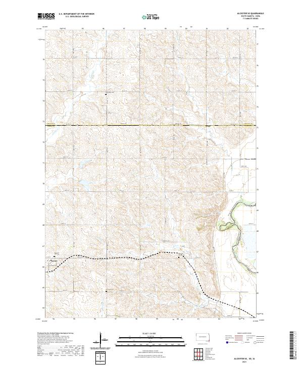
2021 Map of Alcester SE
USGS Topo · Published 2021About this map
Alcester sits at the southwestern corner of this survey, serving as a focal point for a landscape defined by the drainage networks of the Big Sioux River. The area is characterized by a high density of rural burial grounds, including Nathanael Cem, Pleasant Hill Cem, Pleasant Valley Cem, and Erickson Cem, which offer significant touchstones for genealogists tracing early families in the region.
Find a feature on this map
38 named features on this map. Tap any name to fly to it.
Don’t see what you’re looking for? This feature index may not catch every label — zoom into the map to look around manually.
Map Details
Editions of this 2021 Alcester SE Map
This is the sole edition of this map. No revisions or reprints were ever made.
Other maps of this area

1897 · Canton
USGS Topo · 1:125,000

1898 · Elk Point
USGS Topo · 1:125,000

1900 · Canton
USGS Topo · 1:125,000

1901 · Elk Point
USGS Topo · 1:125,000

1907 · Elk Point
USGS Topo · 1:125,000

1955 · Sioux City
USGS Topo · 1:250,000

1955 · Sioux Falls
USGS Topo · 1:250,000

1958 · Sioux City
USGS Topo · 1:250,000

1958 · Sioux Falls
USGS Topo · 1:250,000

1959 · Sioux City
USGS Topo · 1:250,000