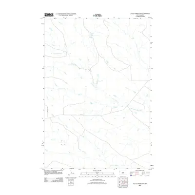
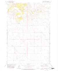
2012 Map of Alkali Creek East
USGS Topo · Published 2012About this map
Ash Coulee sits at the heart of this landscape, marking a central point in a region defined by its complex drainage network. The S Fork Moreau River winds through the central and eastern portions of the terrain, collecting waters from numerous tributaries including Alkali Cr, Cady Cr, and Spur Cr. The layout of the modern road system provides insight into earlier transportation routes, specifically through the alignment of Old Hwy 85 and Old Co Hwy 897. To the south, Fourmile Cr cuts across the lower quadrants, further illustrating the importance of water access in this Butte County environment. This 2012 survey shows a sparsely populated area where cattle ranching and remote land management depend heavily on these seasonal and perennial waterways.
Find a feature on this map
8 named features on this map. Tap any name to fly to it.
Don’t see what you’re looking for? This feature index may not catch every label — zoom into the map to look around manually.
Map Details
Editions of this 2012 Alkali Creek East Map
This is the sole edition of this map. No revisions or reprints were ever made.
Other maps of this area

1935 · Harding
USGS Topo · 1:125,000

1954 · Lemmon
USGS Topo · 1:250,000

1957 · Lemmon
USGS Topo · 1:250,000

1973 · Lone Tree Draw West
USGS Topo · 1:24,000
1973 · Antelope Creek East
USGS Topo · 1:24,000

1973 · Redig
USGS Topo · 1:24,000

1973 · Hells Canyon
USGS Topo · 1:24,000
1977 · Antelope Creek West
USGS Topo · 1:24,000
1978 · Alkali Creek West
USGS Topo · 1:24,000
1978 · Moreau Peak
USGS Topo · 1:24,000