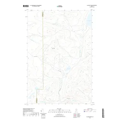
2018 Map of Allagash Pond
USGS Topo · Published 2018About this map
Allagash Stream and its various branches dominate this northern Maine wilderness, winding through the remote timberlands of Piscataquis and Somerset counties. The landscape is defined by its complex hydrography, featuring the expansive Chemquasabamticook Lake in the northeast and smaller bodies of water like Allagash Pond and Corner Pond. The presence of industrial and logging infrastructure is evident through the network of specialized roads, including Boise Cascade Rd and Waleigh Trail Rd, which navigate the elevation changes around Maple Ridge. This survey captures a region where the natural flow of the W Br Allagash Stream and Middle Br Allagash Stream meets the practical demands of the timber industry, providing a clear record of the area's topographical character and water-access routes.
Find a feature on this map
15 named features on this map. Tap any name to fly to it.
Don’t see what you’re looking for? This feature index may not catch every label — zoom into the map to look around manually.
Map Details
Editions of this 2018 Allagash Pond Map
This is the sole edition of this map. No revisions or reprints were ever made.
Other maps of this area

1954 · Baker Lake
USGS Topo · 1:62,500

1954 · Allagash Lake
USGS Topo · 1:62,500

1954 · Presque Isle
USGS Topo · 1:250,000

1955 · Beaver Pond
USGS Topo · 1:62,500

1955 · Clayton Lake
USGS Topo · 1:62,500

1958 · Presque Isle
USGS Topo · 1:250,000

1960 · Presque Isle
USGS Topo · 1:250,000

1961 · Allagash Lake
USGS Topo · 1:62,500

1962 · Baker Lake
USGS Topo · 1:62,500
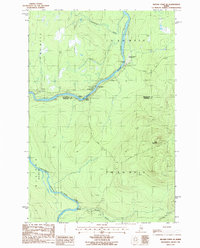
1986 · Beaver Pond SE
USGS Topo · 1:24,000