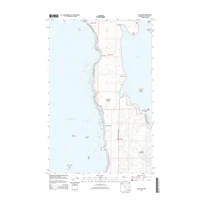
2014 Map of Allens Bay
USGS Topo · Published 2014About this map
Olympic National Park defines this stretch of the Washington coast, where the wilderness of the Pacific Ocean meets the quiet eastern waters of Ozette Lake. The coastline is a complex of rocky points and sheltered coves, including Allens Bay and Ericsons Bay, connected by the Pacific NW National Scenic Trail. This 2014 survey documents the rugged geography of the Olympic Peninsula, from the offshore Carroll Island and Hand Rock to the inland rises of the Olympic Mountains. A notable point of historical interest is the Old Cem near Cemetery Point, suggesting long-standing human presence in an area now primarily managed for conservation. The map also traces Allens Slough and Cedar Cr as they drain the coastal forests, providing a detailed view of the natural hydrology between Kayostia Beach and Sand Point.
Find a feature on this map
30 named features on this map. Tap any name to fly to it.
Don’t see what you’re looking for? This feature index may not catch every label — zoom into the map to look around manually.
Map Details
Editions of this 2014 Allens Bay Map
This is the sole edition of this map. No revisions or reprints were ever made.
Other maps of this area

1935 · Ozette Lake
USGS Topo · 1:62,500

1942 · Ozette Lake
USGS Topo · 1:62,500

1943 · Copalis Beach
USGS Topo · 1:250,000

1951 · Copalis Beach
USGS Topo · 1:250,000

1953 · Cape Flattery
USGS Topo · 1:250,000

1956 · La Push
USGS Topo · 1:62,500

1956 · Ozette Lake
USGS Topo · 1:62,500

1957 · Copalis Beach
USGS Topo · 1:250,000

1963 · Copalis Beach
USGS Topo · 1:250,000

1963 · Cape Flattery
USGS Topo · 1:250,000