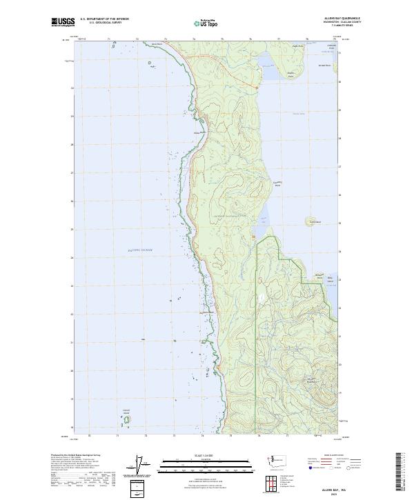
2023 Map of Allens Bay
USGS Topo · Published 2023About this map
Allens Bay and the coastal reaches of Olympic National Park define this stretch of the Pacific coast in Clallam County. The landscape is dominated by the wild interface between the Pacific Ocean and the heavily forested interior, where Ozette Lake reaches toward the shoreline at Ericsons Bay. This modern survey details the protected zones of the Olympic Wilderness and the Quillayute Needles National Wildlife Refuge, highlighting the complex coastline of points and beaches. Hikers and researchers can trace the Pacific Northwest National Scenic Trail as it winds past landmarks like Yellow Banks, Kayostia Beach, and Sand Point. The presence of Cemetery Point on the bay suggests the long-standing human connection to this maritime environment, while the interior peaks of the Olympic Mountains rise to the east.
Find a feature on this map
59 named features on this map. Tap any name to fly to it.
Don’t see what you’re looking for? This feature index may not catch every label — zoom into the map to look around manually.
Map Details
Editions of this 2023 Allens Bay Map
This is the sole edition of this map. No revisions or reprints were ever made.
Other maps of this area

1935 · Ozette Lake
USGS Topo · 1:62,500

1942 · Ozette Lake
USGS Topo · 1:62,500

1943 · Copalis Beach
USGS Topo · 1:250,000

1951 · Copalis Beach
USGS Topo · 1:250,000

1953 · Cape Flattery
USGS Topo · 1:250,000

1956 · La Push
USGS Topo · 1:62,500

1956 · Ozette Lake
USGS Topo · 1:62,500

1957 · Copalis Beach
USGS Topo · 1:250,000

1963 · Copalis Beach
USGS Topo · 1:250,000

1963 · Cape Flattery
USGS Topo · 1:250,000