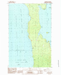
1984 Map of Allens Bay
USGS Topo · Published 1984About this map
Olympic National Park covers much of this coastal landscape, where the Pacific Ocean meets the western edge of Ozette Lake. The coastline is defined by distinctive landforms like Yellow Banks and Kayostla Beach, with several family-named points including Birkestol Point and Shafers Point. Inland, the map documents the Starbuck Mine (Site) near Cedar Creek, suggesting small-scale extraction efforts within the heavily timbered terrain.
Find a feature on this map
30 named features on this map. Tap any name to fly to it.
Don’t see what you’re looking for? This feature index may not catch every label — zoom into the map to look around manually.
Map Details
Editions of this 1984 Allens Bay Map
This is the sole edition of this map. No revisions or reprints were ever made.
Other maps of this area

1935 · Ozette Lake
USGS Topo · 1:62,500

1942 · Ozette Lake
USGS Topo · 1:62,500

1943 · Copalis Beach
USGS Topo · 1:250,000

1951 · Copalis Beach
USGS Topo · 1:250,000

1953 · Cape Flattery
USGS Topo · 1:250,000

1956 · La Push
USGS Topo · 1:62,500

1956 · Ozette Lake
USGS Topo · 1:62,500

1957 · Copalis Beach
USGS Topo · 1:250,000

1963 · Copalis Beach
USGS Topo · 1:250,000

1963 · Cape Flattery
USGS Topo · 1:250,000