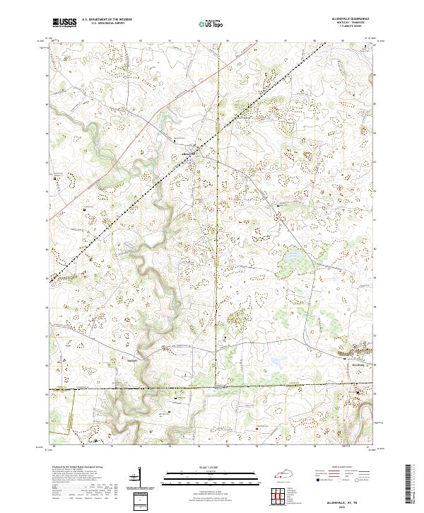
2022 Map of Allensville
USGS Topo · Published 2022About this map
The Allensville community centers this agricultural landscape along the Kentucky-Tennessee border, where the rural character is defined by a dense concentration of family cemeteries and winding watercourses. Significant genealogy resources are scattered across the terrain, including the Allensworth Cem, Belmont Cem, and the Boyd Family Cem to the northeast. These small burial grounds indicate generations of local land ownership and settlement patterns that persisted long after the initial frontier era. The land is drained by the meandering Elk Fork, which joins the Red River at the southern boundary. To the east, the settlement of Keysburg sits near the state line, while Darnell occupies a position further west. The topography is dotted with distinctive features like Mosley Pond and Rum Spring Cr, reflecting a region where natural springs and small waterways dictated the placement of farms and homesteads.
Find a feature on this map
95 named features on this map. Tap any name to fly to it.
Don’t see what you’re looking for? This feature index may not catch every label — zoom into the map to look around manually.
Map Details
Editions of this 2022 Allensville Map
This is the sole edition of this map. No revisions or reprints were ever made.
Other maps of this area

1950 · Allensville
USGS Topo · 1:24,000

1950 · Guthrie
USGS Topo · 1:24,000

1950 · Olmstead
USGS Topo · 1:24,000

1951 · Elkton
USGS Topo · 1:24,000

1951 · Olmstead
USGS Topo · 1:24,000

1951 · Dot
USGS Topo · 1:24,000

1952 · Russellville
USGS Topo · 1:24,000

1952 · Springfield North
USGS Topo · 1:24,000

1956 · Nashville
USGS Topo · 1:250,000

1957 · Adams
USGS Topo · 1:24,000