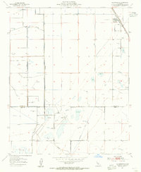
1954 Map of Allensworth
USGS Topo · Published 1955About this map
Allensworth serves as the focal point for this mid-century survey of the southern San Joaquin Valley, situated along the Atchison Topeka and Santa Fe railroad line. The landscape is defined by its industrial and recreational utility, marked by an extensive network of waterways and resource extraction points. The southern reaches of the map, straddling the line between Tulare and Kern counties, reveal a high concentration of private sporting grounds, including the Visalia Gun Club, Tulare Gun Club, and Widgeon Gun Club.
Find a feature on this map
22 named features on this map. Tap any name to fly to it.
Don’t see what you’re looking for? This feature index may not catch every label — zoom into the map to look around manually.
Map Details
Editions of this 1954 Allensworth Map
3 editions found
Other maps of this area

1914 · Lost Hills
USGS Topo · 1:125,000

1929 · Alpaugh
USGS Topo · 1:31,680

1929 · Hacienda Ranch
USGS Topo · 1:31,680

1929 · Pixley
USGS Topo · 1:31,680

1929 · West Alpaugh
USGS Topo · 1:31,680

1929 · Stone
USGS Topo · 1:31,680

1929 · Allensworth
USGS Topo · 1:31,680

1930 · Hamlin School
USGS Topo · 1:31,680

1930 · Pond
USGS Topo · 1:31,680

1930 · Miramonte Ranch
USGS Topo · 1:31,680