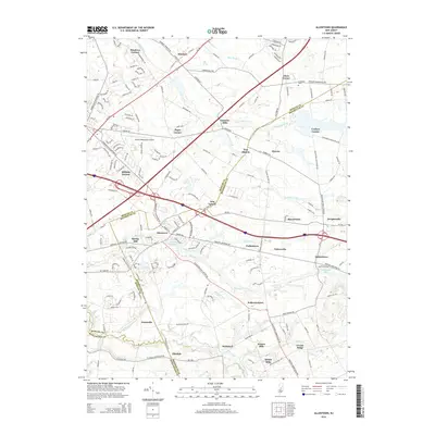
2014 Map of Allentown
USGS Topo · Published 2014About this map
Allentown serves as a central hub on this 2014 survey, where the borders of Mercer, Monmouth, and Burlington counties converge amidst a landscape defined by historic water power and agricultural crossroads. The map documents a high density of named mill sites and ponds, reflecting the area's industrial heritage along waterways like Assunpink Creek, Doctors Cr, and Crosswicks Creek. From Carsons Mills in the north to Kirbys Mills and Homes Mills in the south, these labels indicate a long-standing reliance on the local drainage system for milling and community development.
Find a feature on this map
164 named features on this map. Tap any name to fly to it.
Don’t see what you’re looking for? This feature index may not catch every label — zoom into the map to look around manually.
Map Details
Editions of this 2014 Allentown Map
This is the sole edition of this map. No revisions or reprints were ever made.
Other maps of this area

1888 · Bordentown
USGS Topo · 1:62,500

1888 · New Brunswick
USGS Topo · 1:62,500

1888 · Princeton
USGS Topo · 1:62,500

1888 · Cassville
USGS Topo · 1:62,500

1893 · Bordentown
USGS Topo · 1:62,500

1893 · New Brunswick
USGS Topo · 1:62,500

1894 · Princeton
USGS Topo · 1:62,500

1894 · Cassville
USGS Topo · 1:62,500

1900 · Cassville
USGS Topo · 1:62,500

1901 · New Brunswick
USGS Topo · 1:62,500
Featured Places
- Hamilton Township, NJ
- East Windsor Township, NJ
- West Windsor, NJ
- Robbinsville Township, NJ
- Millstone Township, NJ