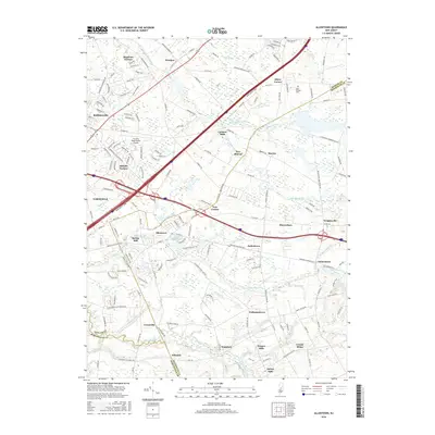
2016 Map of Allentown
USGS Topo · Published 2016About this map
Allentown sits at the heart of this landscape, where the waters of Doctors Creek and Conines Millpond meet. The area is defined by a dense network of suburban developments and crossroads settlements that have evolved alongside major transport corridors like the New Jersey Tpke. A clear distinction in land use is visible between the concentrated residential areas of Meadows Terrace and Hillside Terrace near Robbinsville and the more open spaces to the southeast. Historically significant nodes such as Carsons Mills, Polhemustown, and Imlaystown highlight the region's agricultural and milling roots. To the north, the Trenton-Robbinsville Airport serves as a modern landmark, while the East Windsor Cem and the winding Assunpink Creek offer connection to the local heritage and natural drainage patterns of this Mercer and Monmouth County borderland.
Find a feature on this map
46 named features on this map. Tap any name to fly to it.
Don’t see what you’re looking for? This feature index may not catch every label — zoom into the map to look around manually.
Map Details
Editions of this 2016 Allentown Map
This is the sole edition of this map. No revisions or reprints were ever made.
Other maps of this area

1888 · Bordentown
USGS Topo · 1:62,500

1888 · New Brunswick
USGS Topo · 1:62,500

1888 · Princeton
USGS Topo · 1:62,500

1888 · Cassville
USGS Topo · 1:62,500

1893 · Bordentown
USGS Topo · 1:62,500

1893 · New Brunswick
USGS Topo · 1:62,500

1894 · Princeton
USGS Topo · 1:62,500

1894 · Cassville
USGS Topo · 1:62,500

1900 · Cassville
USGS Topo · 1:62,500

1901 · New Brunswick
USGS Topo · 1:62,500
Featured Places
- Hamilton Township, NJ
- East Windsor Township, NJ
- West Windsor, NJ
- Robbinsville Township, NJ
- Millstone Township, NJ