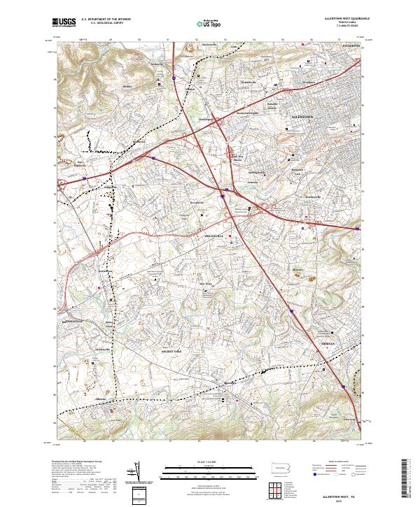
2023 Map of Allentown West
USGS Topo · Published 2023About this map
Allentown and its western suburbs occupy a landscape defined by the winding paths of Jordan Creek, Little Lehigh Creek, and Cedar Creek. This contemporary survey shows a highly developed region where educational institutions like Muhlenberg College and Cedar Crest College are integrated into the urban fabric alongside numerous historic faith communities. The density of cemeteries, from Greenwood Cem to Keneseth Israel Cem, speaks to the long-established lineages of the Lehigh Valley. To the south, the terrain rises toward South Mountain, marking the transition from the valley floor to the prominent ridge. Smaller communities such as Wescosville, Trexlertown, and Emmaus are clearly delineated, showing how once-distinct villages have grown into a contiguous suburban corridor. Major transportation routes like the Rte 222 BYP and Rte 100 BYP underscore the area's role as a regional transit hub while surrounding local landmarks like Trexler Spring and Mosser Spring.
Find a feature on this map
77 named features on this map. Tap any name to fly to it.
Don’t see what you’re looking for? This feature index may not catch every label — zoom into the map to look around manually.
Map Details
Editions of this 2023 Allentown West Map
This is the sole edition of this map. No revisions or reprints were ever made.
Other maps of this area

1888 · Quakertown
USGS Topo · 1:62,500

1890 · Quakertown
USGS Topo · 1:62,500

1894 · Allentown
USGS Topo · 1:62,500

1894 · Quakertown
USGS Topo · 1:62,500

1902 · Boyertown
USGS Topo · 1:62,500

1902 · Slatington
USGS Topo · 1:62,500

1937 · Allentown West
USGS Topo · 1:48,000

1939 · Allentown
USGS Topo · 1:62,500

1942 · Norristown
USGS Topo · 1:125,000

1942 · Allentown West
USGS Topo · 1:62,500