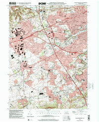
1999 Map of Allentown West
USGS Topo · Published 2001About this map
Allentown serves as the metropolitan anchor for this landscape at the close of the twentieth century, where suburban expansion meets the deeply rooted history of Upper Macungie and Lower Macungie. The map reveals a transition from dense urban street grids near Muhlenberg College to the expanding residential developments of Ancient Oaks and Westwood Heights. A notable concentration of community and recreational spaces defines the geography, from the established grounds of Dorney Park to the Trexler Memorial Park.
Find a feature on this map
87 named features on this map. Tap any name to fly to it.
Don’t see what you’re looking for? This feature index may not catch every label — zoom into the map to look around manually.
Map Details
Editions of this 1999 Allentown West Map
This is the sole edition of this map. No revisions or reprints were ever made.
Other maps of this area

1888 · Quakertown
USGS Topo · 1:62,500

1890 · Quakertown
USGS Topo · 1:62,500

1894 · Allentown
USGS Topo · 1:62,500

1894 · Quakertown
USGS Topo · 1:62,500

1902 · Boyertown
USGS Topo · 1:62,500

1902 · Slatington
USGS Topo · 1:62,500

1937 · Allentown West
USGS Topo · 1:48,000

1939 · Allentown
USGS Topo · 1:62,500

1942 · Norristown
USGS Topo · 1:125,000

1942 · Allentown West
USGS Topo · 1:62,500