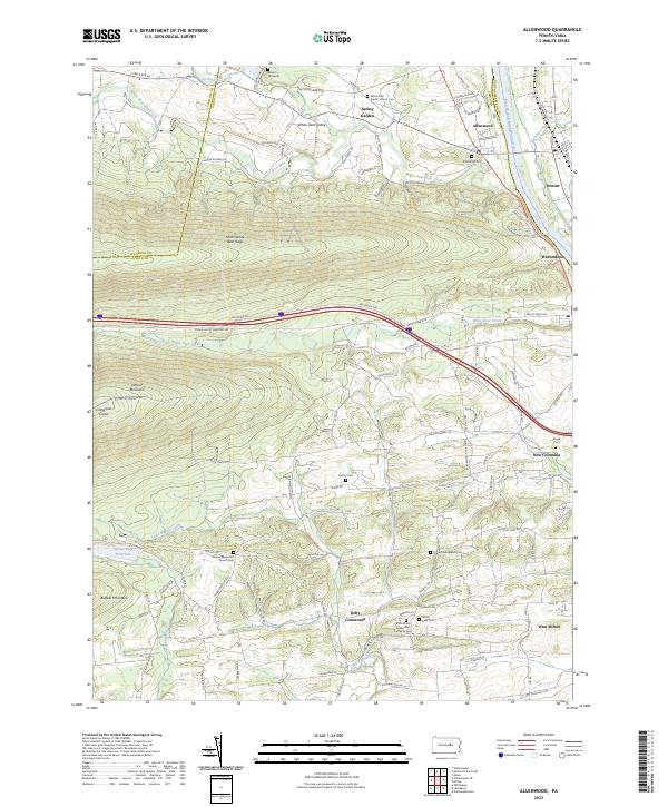
2023 Map of Allenwood
USGS Topo · Published 2023About this map
The West Branch Susquehanna River serves as the dominant eastern boundary for this Union County landscape, where the valley floor transitions into the steep elevations of Nittany Mountain and South White Deer Ridge. This contemporary survey illustrates a deeply rooted rural community, where the settlement patterns at Allenwood and Kelly Crossroads are still defined by historic transportation corridors like the Susquehanna River Water Trail and White Deer Pike.
Find a feature on this map
120 named features on this map. Tap any name to fly to it.
Don’t see what you’re looking for? This feature index may not catch every label — zoom into the map to look around manually.
Map Details
Editions of this 2023 Allenwood Map
This is the sole edition of this map. No revisions or reprints were ever made.
Other maps of this area

1893 · Sunbury
USGS Topo · 1:62,500

1921 · Williamsport
USGS Topo · 1:48,000

1923 · Williamsport
USGS Topo · 1:62,500

1924 · Milton
USGS Topo · 1:62,500

1938 · Mifflinburg
USGS Topo · 1:48,000

1943 · Sunbury
USGS Topo · 1:62,500

1943 · Mifflinburg
USGS Topo · 1:62,500

1944 · Williamsport
USGS Topo · 1:62,500

1950 · Harrisburg
USGS Topo · 1:250,000
1953 · Mifflinburg
USGS Topo · 1:62,500
Featured Places
- White Deer Township, PA
- Buffalo Township, PA
- Kelly Township, PA
- Delaware Township, PA
- Washington Township, PA