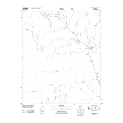
2011 Map of Allie Canyon
USGS Topo · Published 2011About this map
G O S Ranch and Camp Thunderbird anchor the northern reaches of this high-altitude landscape, where the topography is defined by a dense network of drainages and seasonal water sources. The Mimbres River flows through the eastern edge of the quadrangle, passing near the Hicks Cemetery and several named landforms like Allie Canyon and Mimbres Canyon. The reliance on local hydrology is evident in the numerous tanks scattered throughout the terrain, including Cottonwood Tank, Slash Tank, and Gooseman Tank, which serve the needs of this ranching and recreational country. Transportation through the area is facilitated by McKnight Rd and Ponderosa Dr, providing access to high-elevation points such as Gattons Park. In the southeast, the Bear Canyon Reservoir provides a significant water feature near the junction of East Canyon and Allie Canyon.
Find a feature on this map
38 named features on this map. Tap any name to fly to it.
Don’t see what you’re looking for? This feature index may not catch every label — zoom into the map to look around manually.
Map Details
Editions of this 2011 Allie Canyon Map
This is the sole edition of this map. No revisions or reprints were ever made.
Other maps of this area

1909 · Silver City
USGS Topo · 1:125,000

1911 · Alum Mountain
USGS Topo · 1:125,000

1913 · Alum Mountain
USGS Topo · 1:125,000

1937 · Santa Rita
USGS Topo · 1:24,000

1947 · Allie Canyon
USGS Topo · 1:24,000

1947 · Twin Sisters
USGS Topo · 1:24,000

1947 · Fort Bayard
USGS Topo · 1:24,000

1948 · Twin Sisters
USGS Topo · 1:24,000

1948 · Santa Rita
USGS Topo · 1:24,000

1948 · Allie Canyon
USGS Topo · 1:24,000