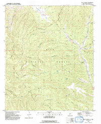
1992 Map of Allie Canyon
USGS Topo · Published 1992About this map
Continental Divide winds through this high-elevation landscape in the early 1990s, defining the drainage patterns within the Gila National Forest. The eastern portion of the map is dominated by the Mimbres River valley, where the Mimbres Ranger Station and Hicks Cem are situated. This area shows a mix of ranching legacy and forest management, with the GOS Ranch in the north and various water sources like Allie Well and Soldier Spring supporting activity in the backcountry.
Find a feature on this map
42 named features on this map. Tap any name to fly to it.
Don’t see what you’re looking for? This feature index may not catch every label — zoom into the map to look around manually.
Map Details
Editions of this 1992 Allie Canyon Map
This is the sole edition of this map. No revisions or reprints were ever made.
Other maps of this area

1909 · Silver City
USGS Topo · 1:125,000

1911 · Alum Mountain
USGS Topo · 1:125,000

1913 · Alum Mountain
USGS Topo · 1:125,000

1937 · Santa Rita
USGS Topo · 1:24,000

1947 · Allie Canyon
USGS Topo · 1:24,000

1947 · Twin Sisters
USGS Topo · 1:24,000

1947 · Fort Bayard
USGS Topo · 1:24,000

1948 · Twin Sisters
USGS Topo · 1:24,000

1948 · Santa Rita
USGS Topo · 1:24,000

1948 · Allie Canyon
USGS Topo · 1:24,000