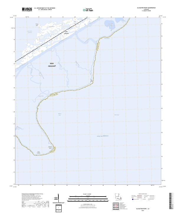
2024 Map of Alligator Point
USGS Topo · Published 2024About this map
New Orleans territory along the eastern coastal margins is defined by a complex network of brackish bayous and tidal lakes where the land dissolves into the Gulf of Mexico. The landscape is dominated by the Intracostal Waterway, which cuts through the marshy terrain to connect Lake Saint Catherine and Lake Catherine with the open waters of Lake Borgne. This contemporary survey illustrates the persistent boundary between Orleans Parish and St. Bernard Parish, a line that meanders through shifting wetlands and across open water south of Shell Point. From Truloix Point in the north down to Alligator Point, the map reveals a fragile geography of points and passes, including Unknown Pass and Blind Bayou, that have shaped the navigational history of this coastal reach.
Find a feature on this map
26 named features on this map. Tap any name to fly to it.
Don’t see what you’re looking for? This feature index may not catch every label — zoom into the map to look around manually.
Map Details
Editions of this 2024 Alligator Point Map
This is the sole edition of this map. No revisions or reprints were ever made.
Other maps of this area

1892 · Chef Menteur
USGS Topo · 1:62,500

1892 · St. Bernard
USGS Topo · 1:62,500

1893 · Rigolets
USGS Topo · 1:62,500

1893 · Shell Beach
USGS Topo · 1:62,500

1935 · English Lookout
USGS Topo · 1:31,680

1936 · North Shore
USGS Topo · 1:31,680

1936 · Chef Menteur
USGS Topo · 1:62,500

1936 · Rigolets
USGS Topo · 1:62,500

1937 · Chef Menteur
USGS Topo · 1:31,680

1939 · Shell Beach
USGS Topo · 1:62,500