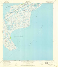
1956 Map of Alligator Point
USGS Topo · Published 1960About this map
The marshy lowlands of Orleans Parish are defined here by a complex network of tidal passes and bayous during the mid-1950s. The Louisville and Nashville railroad corridor serves as the primary terrestrial artery, cutting across the wetlands between Lake St Catherine and the expansive Lake Borgne. This area illustrates the coastal infrastructure of the era, where the Intracoastal Waterway intersects with natural passages like Unknown Pass. Local landmarks such as Shell Point and Alligator Point anchor the shoreline, while numerous water bodies including Big Deedie Lake and Little Bayou Platte dominate the interior landscape. The presence of early offshore activity is noted by an oil well located in the open waters of Alligator Bend, reflecting the industrial expansion into the gulf during this period.
Find a feature on this map
23 named features on this map. Tap any name to fly to it.
Don’t see what you’re looking for? This feature index may not catch every label — zoom into the map to look around manually.
Map Details
Editions of this 1956 Alligator Point Map
2 editions found
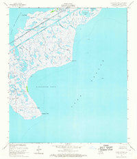
Other maps of this area

1892 · Chef Menteur
USGS Topo · 1:62,500

1892 · St. Bernard
USGS Topo · 1:62,500

1893 · Rigolets
USGS Topo · 1:62,500

1893 · Shell Beach
USGS Topo · 1:62,500

1935 · English Lookout
USGS Topo · 1:31,680

1936 · North Shore
USGS Topo · 1:31,680

1936 · Chef Menteur
USGS Topo · 1:62,500

1936 · Rigolets
USGS Topo · 1:62,500

1937 · Chef Menteur
USGS Topo · 1:31,680

1939 · Shell Beach
USGS Topo · 1:62,500