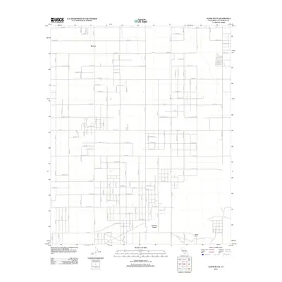
2012 Map of Alpine Butte
USGS Topo · Published 2012About this map
The high desert landscape of the Antelope Valley is meticulously detailed in this 2012 survey, centered on the unincorporated settlement of Redman. The area is defined by a rigorous grid of section-line roads, such as E Avenue F and 90th St E, which cross the arid terrain where local landmarks like the topographic high point of Alpine Butte break the horizon. Small community nodes like Antelope Center and the southern slopes near Rock Cr reveal the steady, spread-out pattern of rural residential development characteristic of northern Los Angeles County. Unlike more densely packed urban areas, this map illustrates the large-lot land use and intermittent drainage patterns of the Mojave transition zone just before the major shifts in 21st-century water management and renewable energy expansion in the region.
Find a feature on this map
100 named features on this map. Tap any name to fly to it.
Don’t see what you’re looking for? This feature index may not catch every label — zoom into the map to look around manually.
Map Details
Editions of this 2012 Alpine Butte Map
This is the sole edition of this map. No revisions or reprints were ever made.
Other maps of this area

1915 · Elizabeth Lake
USGS Topo · 1:125,000

1917 · Elizabeth Lake
USGS Topo · 1:125,000

1930 · Joshua
USGS Topo · 1:24,000

1930 · Lovejoy Springs
USGS Topo · 1:24,000

1930 · Roosevelt School
USGS Topo · 1:24,000

1930 · Casa Desierta
USGS Topo · 1:24,000

1930 · West Alpine Butte
USGS Topo · 1:24,000

1930 · Tierra Bonita
USGS Topo · 1:24,000

1933 · Casa Desierta
USGS Topo · 1:24,000

1933 · Lovejoy Springs
USGS Topo · 1:24,000