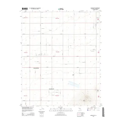
2015 Map of Alpine Butte
USGS Topo · Published 2015About this map
Alpine Butte and Rocky Buttes rise above the high desert floor in this detailed 2015 study of the eastern reaches of Lancaster and Palmdale. The landscape is defined by the rigid grid of the Antelope Valley, where arterial roads like E Lancaster Blvd and E Avenue H intersect at precise mile intervals. This survey illustrates the modern transition from urban clusters to the open Mojave Desert, where the ephemeral drainage of Rock Cr cuts through the arid terrain. The map captures the organized expansion of these desert cities, showing the intricate network of residential streets such as Graphic St and E Pillsbury St as they push into the surrounding basins and foothills. It is a clear record of the region’s topography before further 21st-century development.
Find a feature on this map
55 named features on this map. Tap any name to fly to it.
Don’t see what you’re looking for? This feature index may not catch every label — zoom into the map to look around manually.
Map Details
Editions of this 2015 Alpine Butte Map
This is the sole edition of this map. No revisions or reprints were ever made.
Other maps of this area

1915 · Elizabeth Lake
USGS Topo · 1:125,000

1917 · Elizabeth Lake
USGS Topo · 1:125,000

1930 · Joshua
USGS Topo · 1:24,000

1930 · Lovejoy Springs
USGS Topo · 1:24,000

1930 · Roosevelt School
USGS Topo · 1:24,000

1930 · Casa Desierta
USGS Topo · 1:24,000

1930 · West Alpine Butte
USGS Topo · 1:24,000

1930 · Tierra Bonita
USGS Topo · 1:24,000

1933 · Casa Desierta
USGS Topo · 1:24,000

1933 · Lovejoy Springs
USGS Topo · 1:24,000