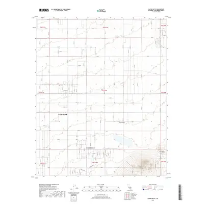
2018 Map of Alpine Butte
USGS Topo · Published 2018About this map
Alpine Butte dominates the southeastern quadrant of this Antelope Valley landscape, rising sharply from the surrounding desert floor. This 2018 survey documents the expansion of Lancaster and Palmdale as their residential grids push eastward into the Mojave Desert. The map reveals a transition from dense suburban development in the west to a rigid, surveyed grid of arterial roads that extend toward the base of Rocky Buttes. These long corridors, such as E Lancaster Blvd and E Ave J 8, reflect the methodical parceling of the high desert for future growth. In the southern portion of the sheet, the natural drainage of Rock Cr cuts across the terrain, running roughly parallel to established transit routes like Barstow Rd and the Antelope Hwy. This cartographic record provides a precise look at the edge of Los Angeles County's urban sprawl during the late 2010s.
Find a feature on this map
44 named features on this map. Tap any name to fly to it.
Don’t see what you’re looking for? This feature index may not catch every label — zoom into the map to look around manually.
Map Details
Editions of this 2018 Alpine Butte Map
This is the sole edition of this map. No revisions or reprints were ever made.
Other maps of this area

1915 · Elizabeth Lake
USGS Topo · 1:125,000

1917 · Elizabeth Lake
USGS Topo · 1:125,000

1930 · Joshua
USGS Topo · 1:24,000

1930 · Lovejoy Springs
USGS Topo · 1:24,000

1930 · Roosevelt School
USGS Topo · 1:24,000

1930 · Casa Desierta
USGS Topo · 1:24,000

1930 · West Alpine Butte
USGS Topo · 1:24,000

1930 · Tierra Bonita
USGS Topo · 1:24,000

1933 · Casa Desierta
USGS Topo · 1:24,000

1933 · Lovejoy Springs
USGS Topo · 1:24,000