2021 Map of Alpine
USGS Topo · Published 2021About this map
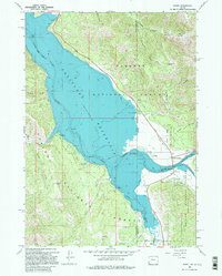
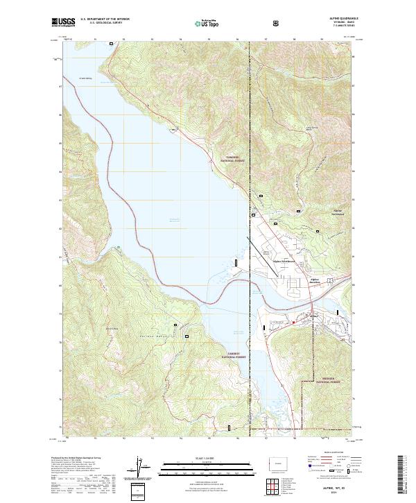
The convergence of the Snake River and Salt River defines the landscape of this region, where the modern settlement of Alpine sits at the gateway to three major national forests. This 2021 survey shows the sprawling Palisades Reservoir dominating the northern half of the quadrangle, bordering the Targhee National Forest and the Caribou National Forest. The map captures the interface between public wilderness and local infrastructure, including the Alpine Airport and the designated Snake River Headwaters Wild and Scenic River.
Find a feature on this map
60 named features on this map. Tap any name to fly to it.
Don’t see what you’re looking for? This feature index may not catch every label — zoom into the map to look around manually.
Map Details
Editions of this 2021 Alpine Map
This is the sole edition of this map. No revisions or reprints were ever made.