1966 Map of Alpine
USGS Topo · Published 1998About this map
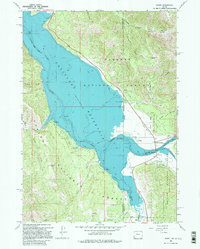
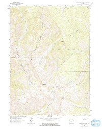
Palisades Reservoir dominates this 1966 topographic study, capturing the confluence of three major river systems at the Idaho and Wyoming border. The newly formed reservoir pools behind the Snake River, while the Salt River and Greys River feed into the southern reaches near the growing settlement of Alpine. This era marks a significant shift for the region as water management and recreation become central to the local landscape, evidenced by the presence of Alpine Campground and McCoy Creek Campground.
Find a feature on this map
34 named features on this map. Tap any name to fly to it.
Don’t see what you’re looking for? This feature index may not catch every label — zoom into the map to look around manually.
Map Details
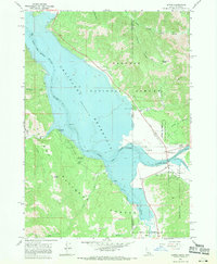
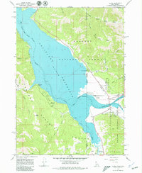
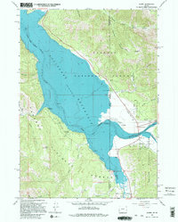
Editions of this 1966 Alpine Map
4 editions found
Other maps of this area

1931 · Jackson
USGS Topo · 1:125,000

1932 · Irwin
USGS Topo · 1:96,000

1935 · Irwin
USGS Topo · 1:125,000

1935 · Jackson
USGS Topo · 1:125,000

1955 · Driggs
USGS Topo · 1:250,000

1958 · Driggs
USGS Topo · 1:250,000

1962 · Driggs
USGS Topo · 1:250,000
1963 · Observation Peak
USGS Topo · 1:24,000
1963 · Ferry Peak
USGS Topo · 1:24,000
1965 · Stewart Peak
USGS Topo · 1:24,000