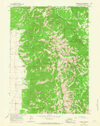
1965 Map of Stewart Peak
USGS Topo · Published 1968About this map
Star Valley defines the western edge of this 1960s survey, where the valley floor meets the rising peaks of the Bridger National Forest. This transition is marked by the East Side Canal, which skirts the base of the mountains to manage water for the agricultural lands below. High above the valley, Stewart Peak and Prater Mountain anchor a landscape defined by deep drainages like Corral Canyon and Prater Canyon. Local genealogy and settlement history are grounded at the Etna Cem, located near the intersection of the valley plains and the mountain foothills. A network of trails, including several marked Pack Trails, provides the only access into the high country, crossing numerous watercourses such as Squaw Creek, Birch Creek, and the North Fork Murphy Creek. These paths reflect the region's enduring reliance on traditional backcountry travel routes during this era of forest management.
Find a feature on this map
21 named features on this map. Tap any name to fly to it.
Don’t see what you’re looking for? This feature index may not catch every label — zoom into the map to look around manually.
Map Details
Editions of this 1965 Stewart Peak Map
This is the sole edition of this map. No revisions or reprints were ever made.
Other maps of this area

1915 · Freedom
USGS Topo · 1:62,500

1921 · Afton
USGS Topo · 1:125,000

1931 · Jackson
USGS Topo · 1:125,000

1932 · Irwin
USGS Topo · 1:96,000

1935 · Irwin
USGS Topo · 1:125,000

1935 · Jackson
USGS Topo · 1:125,000

1955 · Driggs
USGS Topo · 1:250,000

1955 · Preston
USGS Topo · 1:250,000

1958 · Driggs
USGS Topo · 1:250,000

1958 · Preston
USGS Topo · 1:250,000