
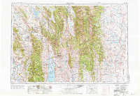
1955 Map of Preston
USGS Topo · Published 1968About this map
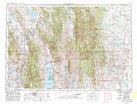
Preston serves as a key agricultural hub in the Bear River valley during this mid-century period, situated near the historic Franklin settlement. The landscape is defined by the high elevations of the Bear River Range and the Wyoming Range, with the Union Pacific RR providing a vital transit link through the corridor. The hydrology of the region is prominent, featuring the expansive Bear Lake on the border with Utah and the complex irrigation systems supported by Alexander Reservoir and the Oneida Narrows Reservoir. To the north, the Blackfoot Lava Field introduces a distinct geological character, contrasting with the dense timber of the Caribou National Forest and Bridger National Forest. Smaller communities like Montpelier, Afton, and Cokeville anchor the rural economy, while the Green River Basin to the east transitions into the high plains of Wyoming. This survey captures a moment of established ranching and nascent water management projects that shaped the high mountain valleys.
Find a feature on this map
100 named features on this map. Tap any name to fly to it.
Don’t see what you’re looking for? This feature index may not catch every label — zoom into the map to look around manually.
Map Details
Editions of this 1955 Preston Map
3 editions found
Other maps of this area

1907 · Gros Ventre
USGS Topo · 1:125,000

1909 · Fremont Peak
USGS Topo · 1:125,000

1909 · Montpelier
USGS Topo · 1:125,000

1910 · Gros Ventre
USGS Topo · 1:125,000

1911 · Montpelier
USGS Topo · 1:125,000

1911 · Slug Creek
USGS Topo · 1:62,500

1912 · Randolph
USGS Topo · 1:125,000

1914 · Henry
USGS Topo · 1:48,000

1914 · Logan
USGS Topo · 1:125,000

1915 · Preston
USGS Topo · 1:96,000