1909 Map of Montpelier
USGS Topo · Published 1957About this map
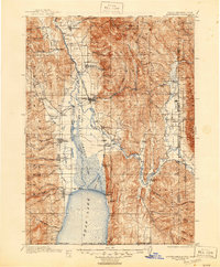
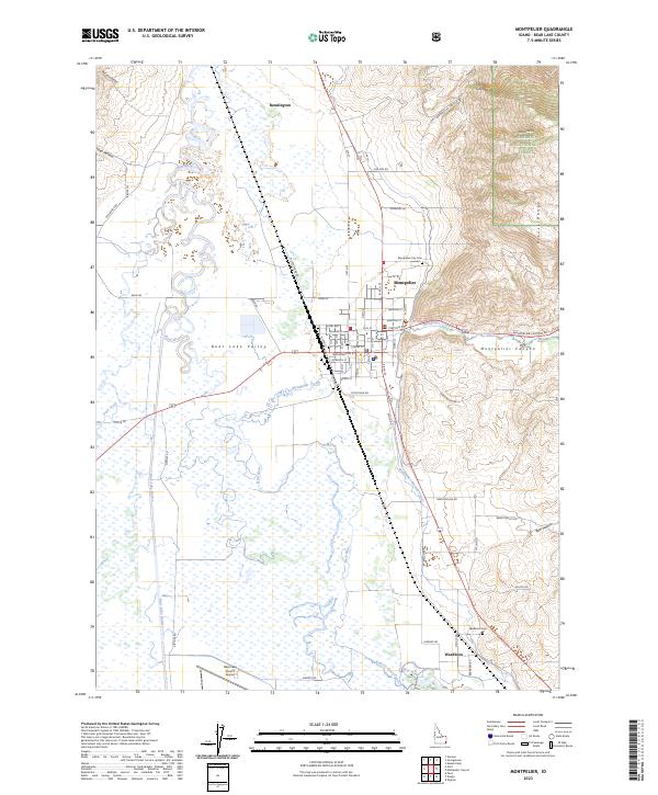
Bear Lake dominates the southern landscape of this 1909 survey, its northern reaches merging into the intricate wetlands of Mud Lake and the Bear Lake Outlet. The regional economy of the early twentieth century is clearly defined by the Oregon Short Line RR and the Telluride Canal, infrastructure critical for transporting goods and managing water in the high desert valleys. Along the western shores and mountain benches, established settlements like Paris, Bloomington, and St Charles mark the progress of early pioneers. To the east, the Thomas Fork River winds through its namesake valley near the Idaho Wyoming Boundary Line. The map documents a rugged interior of canyons and peaks, including Meade Peak and Bald Mountain, while tracing local travel routes such as the Hot Springs Turnpike and the historic Oregon trail corridor.
Find a feature on this map
83 named features on this map. Tap any name to fly to it.
Don’t see what you’re looking for? This feature index may not catch every label — zoom into the map to look around manually.
Map Details
Editions of this 1909 Montpelier Map
This is the sole edition of this map. No revisions or reprints were ever made.
Historical Maps of Montpelier Through Time
8 maps found