
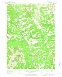
1963 Map of Ferry Peak
USGS Topo · Published 1967About this map
The Snake River carves a deep path through the Grand Canyon of the Snake, serving as the central geographic feature of this high-altitude landscape. During the early 1960s, this area at the intersection of the Targhee National Forest and Bridger National Forest was defined by its drainage systems and trail networks. The confluence of the Greys River and the Snake is a focal point for backcountry access, supported by several established recreation sites like the Bridge Campground and Forks Campground. The terrain is dominated by prominent summits including Ferry Peak, Deadhorse Peak, and Bradley Mountain. Notable water features such as Little Jenny Lake and the winding Wolf Creek illustrate the complex hydrology of the Wyoming-Lincoln county line before more modern infrastructure altered the more remote reaches of these national forests.
Find a feature on this map
42 named features on this map. Tap any name to fly to it.
Don’t see what you’re looking for? This feature index may not catch every label — zoom into the map to look around manually.
Map Details
Editions of this 1963 Ferry Peak Map
This is the sole edition of this map. No revisions or reprints were ever made.
Other maps of this area

1931 · Jackson
USGS Topo · 1:125,000

1932 · Irwin
USGS Topo · 1:96,000

1935 · Irwin
USGS Topo · 1:125,000

1935 · Jackson
USGS Topo · 1:125,000

1955 · Driggs
USGS Topo · 1:250,000

1958 · Driggs
USGS Topo · 1:250,000

1962 · Driggs
USGS Topo · 1:250,000

1963 · Munger Mountain
USGS Topo · 1:24,000

1963 · Observation Peak
USGS Topo · 1:24,000
1965 · Deer Creek
USGS Topo · 1:24,000