
1963 Map of Munger Mountain
USGS Topo · Published 1966About this map
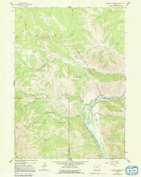
Astoria Mineral Hot Springs sits along the southern curve of the Snake River, marking a focal point of activity in this montane landscape during the early 1960s. The region is defined by the steep elevation of the Teton Range and the high peak of Munger Mountain, where the boundaries of the Teton National Forest and Targhee National Forest meet. These protected lands are crisscrossed by a network of drainage systems, including Dog Creek and Pritchard Creek, and mapped routes like the Pack Trail.
Find a feature on this map
31 named features on this map. Tap any name to fly to it.
Don’t see what you’re looking for? This feature index may not catch every label — zoom into the map to look around manually.
Map Details
Editions of this 1963 Munger Mountain Map
2 editions found
Other maps of this area

1931 · Jackson
USGS Topo · 1:125,000

1935 · Jackson
USGS Topo · 1:125,000

1955 · Driggs
USGS Topo · 1:250,000

1958 · Driggs
USGS Topo · 1:250,000

1962 · Driggs
USGS Topo · 1:250,000

1963 · Jackson
USGS Topo · 1:24,000

1963 · Teton Pass
USGS Topo · 1:24,000

1963 · Observation Peak
USGS Topo · 1:24,000

1963 · Ferry Peak
USGS Topo · 1:24,000

1965 · Camp Davis
USGS Topo · 1:24,000