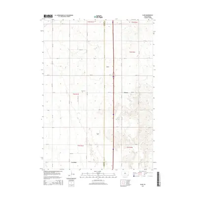
2015 Map of Alsen
USGS Topo · Published 2015About this map
The border of Clay and Union Counties bisects this agricultural landscape in southeastern South Dakota. The tiny settlement of Alsen sits at a central crossroads, while other named locations like Hill-Side and Greenfield mark the rural township's historical hubs. The terrain is defined by the winding paths of Brule Cr and Baptist Cr, which carve through the grid-patterned section lines and gravel roads. Researchers and genealogists will find the Rockfield Cem located on Rockfield Rd, north of Howard Field. The map illustrates a high degree of land partitioning, characteristic of the region's farming heritage, with established routes such as 307th St and 470th Ave connecting isolated farmsteads and rural properties.
Find a feature on this map
33 named features on this map. Tap any name to fly to it.
Don’t see what you’re looking for? This feature index may not catch every label — zoom into the map to look around manually.
Map Details
Editions of this 2015 Alsen Map
This is the sole edition of this map. No revisions or reprints were ever made.
Other maps of this area

1897 · Canton
USGS Topo · 1:125,000

1898 · Elk Point
USGS Topo · 1:125,000

1900 · Canton
USGS Topo · 1:125,000

1901 · Elk Point
USGS Topo · 1:125,000

1907 · Elk Point
USGS Topo · 1:125,000

1955 · Sioux City
USGS Topo · 1:250,000

1955 · Sioux Falls
USGS Topo · 1:250,000

1958 · Sioux City
USGS Topo · 1:250,000

1958 · Sioux Falls
USGS Topo · 1:250,000

1959 · Sioux City
USGS Topo · 1:250,000