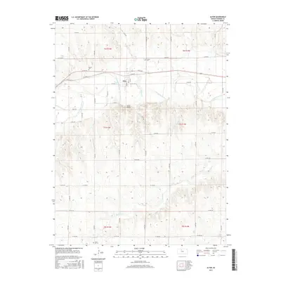
2015 Map of Alton
USGS Topo · Published 2015About this map
Alton serves as the central hub of this north-central Kansas landscape, situated where the S Fork Solomon River winds through the valley. The terrain is defined by the prominent Alton Bluffs rising south of the river, while the surrounding tablelands are dissected by drainage systems including Medicine Creek and Crooked Creek. For those researching local family history, several burial grounds are preserved across the sections, including Pioneer Cem west of town and Sumner Cem to the east. Farther south near the township line lies Mount Ayr Cem. The grid of section roads, from W 50th Dr in the north down to W 130th Dr, illustrates the enduring structure of the Public Land Survey System that governs the agricultural distribution of Osborne County.
Find a feature on this map
27 named features on this map. Tap any name to fly to it.
Don’t see what you’re looking for? This feature index may not catch every label — zoom into the map to look around manually.
Map Details
Editions of this 2015 Alton Map
This is the sole edition of this map. No revisions or reprints were ever made.
Other maps of this area

1893 · Smith Center
USGS Topo · 1:125,000

1893 · Phillipsburg
USGS Topo · 1:125,000

1896 · Osborne
USGS Topo · 1:125,000

1896 · Plainville
USGS Topo · 1:125,000

1953 · Bloomington
USGS Topo · 1:24,000

1953 · Woodston
USGS Topo · 1:24,000

1953 · Alton
USGS Topo · 1:24,000

1955 · Beloit
USGS Topo · 1:250,000

1959 · Beloit
USGS Topo · 1:250,000

1961 · Kirwin SE
USGS Topo · 1:24,000