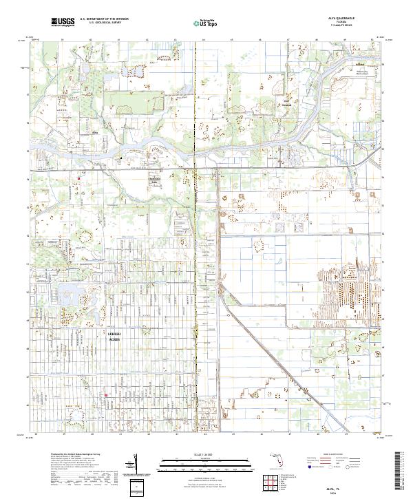
2024 Map of Alva
USGS Topo · Published 2024About this map
The Caloosahatchee River corridor serves as the primary artery for this region of Southwest Florida, defining the development patterns of Alva and Fort Denaud. In the northern half of the map, the landscape is shaped by natural drainage like Spanish Creek and Cypress Creek, while the southern portion transition into the highly engineered water management systems of Lehigh Acres. Here, a dense network of residential streets is interspersed with man-made waterways such as the Mike Canal, King Canal, and West Baker Canal. This map captures the contrast between the established riverfront communities and the massive inland residential platting. Local history remains visible through features like the Old Lake Place Cem and the recreational access provided by the Caloosahatchee Regional Park and the Okeechobee Waterway Canoe Trl.
Find a feature on this map
139 named features on this map. Tap any name to fly to it.
Don’t see what you’re looking for? This feature index may not catch every label — zoom into the map to look around manually.
Map Details
Editions of this 2024 Alva Map
This is the sole edition of this map. No revisions or reprints were ever made.
Other maps of this area

1956 · Telegraph Swamp
USGS Topo · 1:24,000

1956 · West Palm Beach
USGS Topo · 1:250,000

1957 · West Palm Beach
USGS Topo · 1:250,000

1957 · Telegraph Swamp SE
USGS Topo · 1:24,000

1958 · West Palm Beach
USGS Topo · 1:250,000

1958 · Felda
USGS Topo · 1:24,000

1958 · Olga
USGS Topo · 1:24,000

1958 · Alva SW
USGS Topo · 1:24,000

1958 · Alva
USGS Topo · 1:24,000

1958 · Sears
USGS Topo · 1:24,000