Old Maps of Lee County, Florida
Explore 193 old maps of Lee County, spanning from 1956 to today. These high-resolution historic maps reveal how streets, neighborhoods, landmarks, and natural features evolved over time — perfect for genealogy, metal detecting, research, and local history exploration.
What you can do with these maps:
- See how Lee County changed over time: Compare historical maps to modern-day views to trace roads, homesites, rail lines & more.
- View detailed metadata: Each map includes creators, publishers, year, scale, and archive source.
- Overlay maps with satellite & LiDAR: Visualize the past alongside modern tools to explore terrain & human change.
- Trusted historical sources: Maps sourced from the USGS, Library of Congress, and other archives.
- Access maps your way: View online, download high-res files, or order prints for personal or research use.
Start exploring old maps of Lee County to uncover forgotten places, hidden landmarks, and the deep history beneath your feet.
Lee County, FL maps
(193)- 1956 Map of Telegraph Swamp, 1957 Print
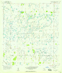
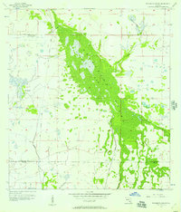 1956 Telegraph Swamp1957 Print · USGSFlorida's Gulf Coast interior was a landscape of vast ranchlands and wetlands in the 1950s. Genealogists and historians can trace the early footprint of Babcock Ranch and identify remnants of an Old Railroad Grade through the heart of Telegraph Swamp.3 unique versions available
 - 1956 Map of Punta Gorda SE, 1957 Print
 1956 Punta Gorda SE1957 Print · USGSCoastal Charlotte County appears here in the mid-fifties, showing a landscape defined by mangrove keys and the early infrastructure of the Florida Gulf Coast. Researchers can trace the Atlantic Coast Line rail route and locate local landmarks like Cockroach Mound, John Quiet Lakes, and South Punta Gorda Heights.5 unique versions available
 - 1956 Map of West Palm Beach, 1964 Print
 1956 West Palm Beach1964 Print · USGSSouth Florida during the mid-fifties exhibits a fascinating balance between expanding coastal cities and the vast interior wetlands. Researchers can trace the development of inland settlements like Immokalee and Okeelanta or locate vanished landmarks like Chosen and Buckingham Cem.2 unique versions available
 - 1956 Map of Tampa, 1964 Print
 1956 Tampa1964 Print · USGSThe Florida Gulf Coast thrived in the mid-fifties, from the bustling docks of Tampa to the quiet shores of Sanibel. Genealogists and historians can trace old rail lines like the Atlantic Coast Line or find early layouts of Port Charlotte and Bokeelia.2 unique versions available
 - 1956 Map of Charlotte Harbor, 1982 Print
 1956 Charlotte Harbor1982 Print · USGSCoastal Florida in the mid-fifties reveals the early growth of bayside communities and the preservation of vast wetland refuges. Genealogists and historians can trace rail lines like the Seaboard Air Line and find historic waterfront locales from Boca Grande to Punta Gorda.
 - 1957 Map of West Palm Beach
 1957 West Palm Beach1957 Print · USGSSouthern Florida in the mid-fifties reveals a landscape defined by massive drainage canals and the early expansion of the Gold Coast. Genealogists and historians can trace industrial outposts like the Sugar plant and Everglades Labor Center, or locate the Jupiter Auxiliary Air Force Base.
 - 1957 Map of Punta Gorda SW, 1958 Print
 1957 Punta Gorda SW1958 Print · USGSThe Florida Gulf Coast near the Charlotte and Lee county line is captured in the late fifties before modern coastal development. Maritime historians can trace historical landmarks and natural channels like John Quiet Mound, Cayo Pelau, and Boggess Hole.4 unique versions available
 - 1957 Map of Tuckers Corner, 1958 Print
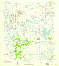
 1957 Tuckers Corner1958 Print · USGSThe Florida interior at the edge of the wetlands is captured here in the mid-fifties, showing a landscape defined by seasonal ponds and early transit lines. Genealogists and local historians can trace the boundary between Charlotte Co and Lee Co or locate the rural settlement at Tuckers Corner near the Atlantic Coast Line railroad.3 unique versions available
 - 1957 Map of Placida, 1958 Print
 1957 Placida1958 Print · USGSThe Charlotte County coastline in the mid-1950s was a network of barrier islands and vital rail links. Trace the southern terminus of the Seaboard Air Line through Placida or locate the old Ferry Landing sites connecting Little Gasparilla Island and Boca Grande.4 unique versions available
 - 1957 Map of Gilchrist, 1958 Print
 1957 Gilchrist1958 Print · USGSCoastal Florida interior lands at the Lee and Charlotte county line show a landscape dominated by wetlands and early rail infrastructure in the late fifties. Trace the path of the Atlantic Coast Line or locate the settlement at Gilchrist and the residential plats of South Punta Gorda Heights.3 unique versions available
 - 1957 Map of Telegraph Swamp SE, 1959 Print
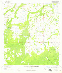
 1957 Telegraph Swamp SE1959 Print · USGSThe Florida interior during the mid-1950s reveals a landscape where the corners of four counties meet among sprawling wetlands. Researchers can locate the Fort Denaud Cem and trace seasonal watercourses like Jacks Branch and Cypress Cr.3 unique versions available
 - 1958 Map of West Palm Beach
 1958 West Palm Beach1958 Print · USGSSouth Florida in the late fifties was a land of transition between massive agricultural works and rapid coastal growth. Genealogists and historians can trace old canal networks, early rail lines like the Florida East Coast, and landmarks like the Moore Haven Lock or Jupiter Auxiliary Air Force Base.2 unique versions available
 - 1958 Map of Matlacha
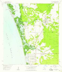
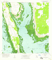
 1958 Matlacha1958 Print · USGSCoastal Lee County is shown here in the late fifties as the bridge network linked isolated islands to the Florida mainland. Researchers can trace the early layout of Matlacha, the location of the Pine Island Lookout Tower, and Indian Field.4 unique versions available
 - 1958 Map of Bonita Springs, 1959 Print
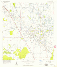
 1958 Bonita Springs1959 Print · USGSCoastal Southwest Florida comes alive in the late fifties, showing the early growth of Bonita Springs and its surrounding wetlands. Researchers can trace the original rail corridor of the Atlantic Coast Line and find mid-century landmarks like the Drive-in Theater and Crest Lawn Cem.5 unique versions available
 - 1958 Map of Corkscrew NW, 1959 Print
 1958 Corkscrew NW1959 Print · USGSThe Everglades borderlands of Lee and Collier Counties appear in the late fifties as a landscape of vast wetlands and emergent islands. Researchers can trace the early boundaries of the Corkscrew Swamp Sanctuary and locate features like Panther Island and the Flowing Well.4 unique versions available
 - 1958 Map of Captiva, 1959 Print
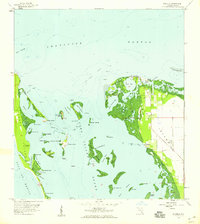
 1958 Captiva1959 Print · USGSThe Lee County coastline in the late fifties shows the barrier islands of Captiva Island and North Captiva Island before modern development. Trace local landmarks like the Chapel by the Sea or find the remote Big Bird Rookery.5 unique versions available
 - 1958 Map of Port Boca Grande, 1959 Print
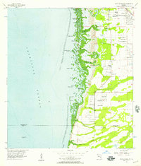
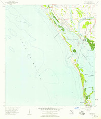
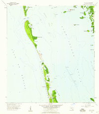
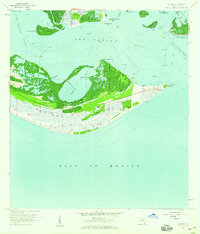
 1958 Port Boca Grande1959 Print · USGSGasparilla Island at the end of the fifties serves as a vital maritime hub where the rail line meets the sea. Genealogists and historians can trace the early layout of Boca Grande, the Seaboard Air Line tracks, and landmarks like the Lighthouse.5 unique versions available
 - 1958 Map of Fort Myers NW, 1959 Print
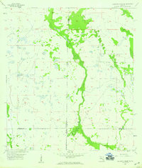
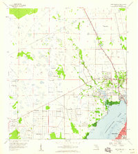 1958 Fort Myers NW1959 Print · USGSThe Caloosahatchee River waterfront and the emerging suburbs of North Fort Myers come alive in this late-fifties topographic record. Local historians can trace the foundations of the community through the English Sch, the State Prison Camp, and the Old Railroad Grade that once served the region.5 unique versions available
 - 1958 Map of Estero, 1959 Print
 1958 Estero1959 Print · USGSIn the late fifties, the Lee County coastline around Estero was a mosaic of mangrove keys, citrus groves, and small rail-side settlements. Researchers can locate the Koreshan Unity Cem, the Lookout Tower, and the many artesian wells that once dotted this landscape.6 unique versions available
 - 1958 Map of Fort Myers SW, 1959 Print
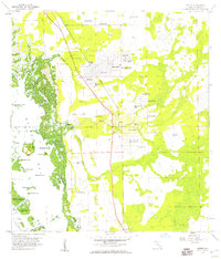
 1958 Fort Myers SW1959 Print · USGSThe Caloosahatchee River waterfront and Southwest Florida's early development are captured here in the late fifties. Genealogists and researchers can trace local landmarks like Orangewood Sch, Truckland, and the Iona Sch (Abandoned).6 unique versions available
 - 1958 Map of Olga, 1959 Print
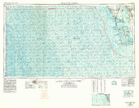
 1958 Olga1959 Print · USGSCoastal Florida is seen transitioning from wetlands to planned communities in the late fifties. Researchers can trace the early grid of Lehigh Acres and the rural origins of Buckingham alongside the Old Railroad Grade and Caloosahatchee River.4 unique versions available
 - 1958 Map of Sanibel, 1959 Print
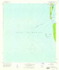
 1958 Sanibel1959 Print · USGSSanibel Island and the surrounding Lee County waters appear here in the late fifties, showcasing a quiet coastal era defined by fishing and maritime navigation. Researchers can locate the Sanibel Island Lighthouse, the local Sanibel Sch, and the southern docks of St James City.4 unique versions available
 - 1958 Map of Pine Island Center, 1959 Print
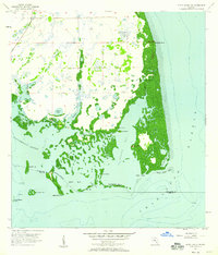
 1958 Pine Island Center1959 Print · USGSCoastal Lee County is documented here in the late fifties, showcasing the intricate mangrove shorelines and early island settlements. Genealogists and historians can trace the foundations of Matlacha, St James City, and the inland hub at Pine Island Center.6 unique versions available
 - 1958 Map of Alva SW, 1959 Print
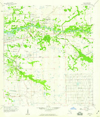
 1958 Alva SW1959 Print · USGSLee County is captured during the initial mid-century development of its inland wetlands and planned communities. Trace the early footprint of Lehigh Acres alongside natural features like Halfway Pond and the Able Canal.5 unique versions available
 - 1958 Map of Bokeelia, 1959 Print
 1958 Bokeelia1959 Print · USGSThe northern tip of Pine Island and its surrounding barrier keys are captured here in the late fifties as a network of fishing villages and archaeological sites. Researchers can locate ancient landmarks like Howard Mound and trace the original footprints of Bokeelia and Pineland.5 unique versions available
Showing maps 1-25 of 193
Top cities of Lee County
- Cape Coral historical maps
- Lehigh Acres historical maps
- Fort Myers historical maps
- North Fort Myers historical maps
- Bonita Springs historical maps
- Fort Myers Beach historical maps
See more
Frequently asked questions
- What are the different types of historical maps available for Lee County?
- What is the oldest map of Lee County?
- Where can I purchase historical maps of Lee County for my home or office?
- Where can I download high-res historical maps of Lee County?
- Are there historical topographic maps available for Lee County?
- Is there historical aerial imagery available for Lee County?
- Where are historical maps of Lee County sourced from?