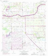
1958 Map of Alva
USGS Topo · Published 1987About this map
The Caloosahatchee River serves as the central artery of this Florida landscape, defining the boundary between established riverside settlements and the nascent development to the south. This 1950s survey, with mid-1970s revisions, highlights the contrast between the historic community of Alva and the rapidly expanding gridded streets of Lehigh Acres. The topography is shaped by an extensive network of water management features, including the Hickey Creek Canal and a dense system of irrigation and drainage channels such as the Love 1 Canal and King Canal. To the northeast, the settlement of Denaud sits along the river's bend, while Fort Simmons Branch and Banana Branch feed into the waterway. Industrial activity is represented by a large Quarry and scattered Gravel Pits, reflecting the literal extraction of materials used to build the region's mid-century infrastructure.
Find a feature on this map
27 named features on this map. Tap any name to fly to it.
Don’t see what you’re looking for? This feature index may not catch every label — zoom into the map to look around manually.
Map Details
Editions of this 1958 Alva Map
4 editions found
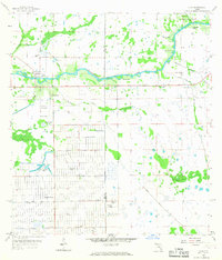
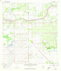
Other maps of this area

1956 · Telegraph Swamp
USGS Topo · 1:24,000

1956 · West Palm Beach
USGS Topo · 1:250,000

1957 · West Palm Beach
USGS Topo · 1:250,000

1957 · Telegraph Swamp SE
USGS Topo · 1:24,000

1958 · West Palm Beach
USGS Topo · 1:250,000

1958 · Felda
USGS Topo · 1:24,000

1958 · Olga
USGS Topo · 1:24,000

1958 · Alva SW
USGS Topo · 1:24,000

1958 · Alva
USGS Topo · 1:24,000

1958 · Sears
USGS Topo · 1:24,000