
1958 Map of Olga
USGS Topo · Published 1959About this map
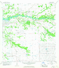
The Caloosahatchee River serves as the central artery of this late-1950s landscape, winding through a region transitioning from subtropical wetlands toward early suburban development. The settlement of Olga sits at a narrow point in the river, while to the south, the massive planned grid of Lehigh Acres begins to emerge from the drainage patterns of the Fox Canal and West Easy Canal. This period marks a shift in land use, as historical transportation routes like the Old Railroad Grade and a Runway Abandoned contrast with the growing residential footprints of Ft Myers Shores and Telegraph Estates. Numerous Flowing Wells are mapped across the terrain, indicating the importance of groundwater for local agriculture and early inhabitants. Smaller waterways like Telegraph Creek and Hickey Creek feed into the main river, while the area near Buckingham retains a rural character with its own local Cem.
Find a feature on this map
29 named features on this map. Tap any name to fly to it.
Don’t see what you’re looking for? This feature index may not catch every label — zoom into the map to look around manually.
Map Details
Editions of this 1958 Olga Map
4 editions found
Other maps of this area

1956 · Telegraph Swamp
USGS Topo · 1:24,000

1956 · West Palm Beach
USGS Topo · 1:250,000

1957 · West Palm Beach
USGS Topo · 1:250,000

1957 · Tuckers Corner
USGS Topo · 1:24,000

1957 · Telegraph Swamp SE
USGS Topo · 1:24,000

1958 · West Palm Beach
USGS Topo · 1:250,000

1958 · Alva SW
USGS Topo · 1:24,000

1958 · Fort Myers
USGS Topo · 1:24,000

1958 · Alva
USGS Topo · 1:24,000

1958 · Alva SE
USGS Topo · 1:24,000