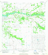
1958 Map of Olga
USGS Topo · Published 1967About this map
The Caloosahatchee River bisects this landscape of southwestern Florida during a period of mid-century suburban expansion. The community of Olga sits north of the river, while newer developments like Ft Myers Shores and the early grid of Lehigh Acres illustrate the era's changing land use. Away from the riverside settlements, the terrain is defined by a dense network of flowing wells and intricate waterways, including Telegraph Creek and Hickey Creek, which feeds into the substantial Hickey Creek Swamp. Significant genealogical landmarks appear at the Buckingham Cem and Alva Cem. Evidence of past industry and transportation is visible in the Old Railroad Grade (Abandoned) and a runway in the southern portion of the quadrangle, reflecting a transition from rural homesteads to more structured infrastructure.
Find a feature on this map
26 named features on this map. Tap any name to fly to it.
Don’t see what you’re looking for? This feature index may not catch every label — zoom into the map to look around manually.
Map Details
Editions of this 1958 Olga Map
4 editions found
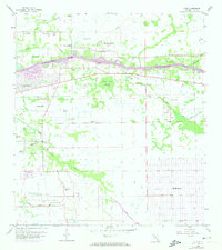
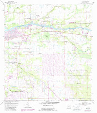
Other maps of this area

1956 · Telegraph Swamp
USGS Topo · 1:24,000

1956 · West Palm Beach
USGS Topo · 1:250,000

1957 · West Palm Beach
USGS Topo · 1:250,000

1957 · Tuckers Corner
USGS Topo · 1:24,000

1957 · Telegraph Swamp SE
USGS Topo · 1:24,000

1958 · West Palm Beach
USGS Topo · 1:250,000

1958 · Olga
USGS Topo · 1:24,000

1958 · Alva SW
USGS Topo · 1:24,000

1958 · Fort Myers
USGS Topo · 1:24,000

1958 · Alva
USGS Topo · 1:24,000